
Taraba State
“Nature's Gift to the Nation”
- Capital
- Jalingo
- Created
- 1991 27 Aug
- Population
- 3.6M 2022 est.
- Land area
- 54,473 km²
- Density
- 66 people / km²
- LGAs
- 16 local governments
- IGR
- ₦10.9bn 2023
Overview
Taraba State is in the North-East geopolitical zone of Nigeria, with its capital at Jalingo. It was created on 27 August 1991 from Gongola State (split into Adamawa and Taraba). It has an estimated population of 3,609,800 (2022) across 54,473 km², administered through 16 local government areas.
Major towns
- Jalingo
- Wukari
- Takum
- Gembu
- Bali
- Serti
- Ibi
- Zing
- Mutum Biyu
- Donga
Leadership

His Excellency Agbu Kefas
APC In office since 29 May 2023 · 1st term
View profileDeputy Governor
Aminu Abdullahi Alkali
History
Taraba is named after the Taraba River, which crosses the south of the state. The area includes Wukari, historic centre of the Jukun Kwararafa kingdom, and the Muri Emirate, established during the nineteenth-century Fulani jihad. The Mambilla region in the south-east has been continuously inhabited for around five millennia and is regarded by some scholars as part of the Bantu cradle.
In the colonial era the area formed parts of Muri and Adamawa provinces, while the Mambilla Plateau lay in the British Northern Cameroons until the 1961 plebiscite brought it into Nigeria. After independence it belonged to the Northern Region, the North-Eastern State (1967) and Gongola State (1976).
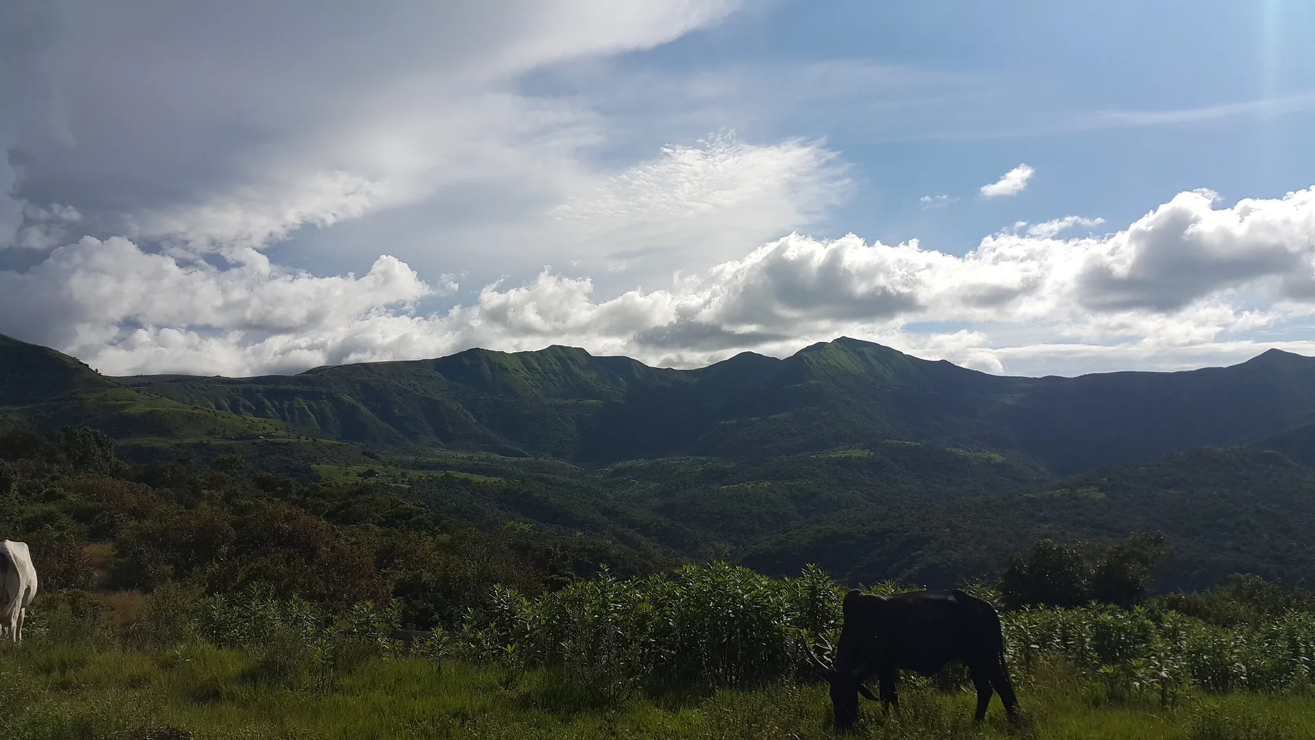
Taraba State was created from the southern part of Gongola State on 27 August 1991 by the military government of General Ibrahim Babangida, combining the former Wukari, Mambilla and Muri divisions. The state has around 80 ethnic groups and is known for its varied landscape, from the Benue valley lowlands to the Mambilla Plateau and Chappal Waddi, Nigeria's highest peak.
People & Culture
Ethnic groups
- Jukun
- Fulani
- Mumuye
- Mambila
- Kuteb
- Chamba
- Tiv
- Wurkum
- Jenjo
- Ichen
- Tigon
- Jibu
- Ndola
Languages
- Hausa
- Fulfulde
- English
- Jukun
- Mumuye
- Mambila
- Kuteb
- Chamba
- Tiv
- Wurkum
Traditional institutions
- Kwararafa Kingdom (Aku Uka of Wukari)
- Muri Emirate
- Mambilla Chiefdom (Gembu)
- Takum Chiefdom
Economy & Natural Resources
Agriculture is the main occupation in Taraba. Cash crops include tea and coffee on the Mambilla Plateau, groundnut and cotton, while maize, rice, sorghum, millet, cassava and yam are produced in commercial quantities; Wukari is known for its large yam market. Cattle, sheep and goats are reared in large numbers on the Mambilla Plateau and in the Benue and Taraba valleys, and communities along the Benue, Taraba and Donga rivers fish year-round.
Mineral resources include barytes, bauxite, graphite, limestone, gypsum, kaolin, feldspar and gemstones. The federal Mambilla hydropower project is planned in Sardauna LGA. NBS data put Taraba's internally generated revenue at about N10.9 billion in 2023.
Key sectors
- Agriculture
- Livestock
- Tea and coffee
- Fisheries
- Solid minerals
- Eco-tourism
- Hydropower
Agricultural produce
- Yam
- Cassava
- Maize
- Rice
- Sorghum
- Millet
- Groundnut
- Tea
- Coffee
- Cotton
- Soybeans
- Cattle
Solid minerals
- Barytes
- Bauxite
- Graphite
- Limestone
- Gypsum
- Kaolin
- Feldspar
- Mica
- Pyrite
Gemstones
- Gemstones (unspecified)
Raw materials
- Tea
- Timber
- Yam
- Cassava
- Palm oil
- Cocoa
- Gum arabic
- Barytes
Internally generated revenue: ₦10.9bn (2023) · Source: NBS, Internally Generated Revenue at State Level 2023 (https://nigerianstat.gov.ng/download/1241579)
Investment Opportunities
Tea and highland agriculture
The Mambilla Plateau's temperate climate supports tea, coffee and dairy farming.
Eco-tourism
Gashaka-Gumti National Park, the Mambilla Plateau and Chappal Waddi can support lodges and guided tourism.
Agro-processing
Large yam, cassava and rice output creates demand for storage and processing.
Solid minerals
Barytes, kaolin, limestone and gemstones offer mining and processing opportunities.
Interested in Taraba?
Submit your proposal and the Secretariat will connect you with the state's investment agency.
Tourism & Heritage
Mambilla Plateau
Highland plateau around Gembu with rolling grasslands, tea estates and a temperate climate.
Gashaka-Gumti National Park
Nigeria's largest national park, on the Cameroon border, home to chimpanzees and other wildlife.
Chappal Waddi
Nigeria's highest mountain, rising to about 2,419 m in the Gashaka area.
Nwunyu Fishing Festival, Ibi
Annual fishing festival with canoe racing and cultural dances held around April.
Kakara Highland Tea Estate
Tea plantation on the Mambilla Plateau.
Gallery
Local Government Areas
16 local government areas
- Ardo Kola
- Bali
- Donga
- Gashaka
- Gassol
- Ibi
- Jalingo
- Karim Lamido
- Kurmi
- Lau
- Sardauna
- Takum
- Ussa
- Wukari
- Yorro
- Zing