
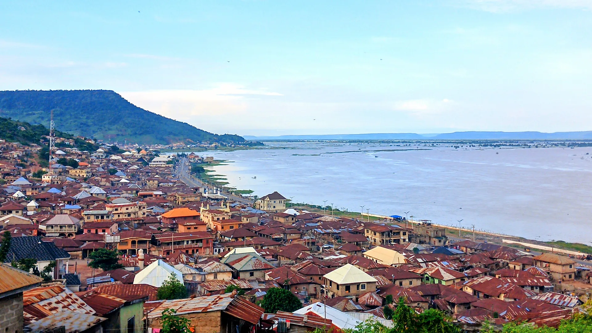
Kogi State
“The Confluence State”
- Capital
- Lokoja
- Created
- 1991 27 Aug
- Population
- 4.5M 2022 est.
- Land area
- 29,833 km²
- Density
- 150 people / km²
- LGAs
- 21 local governments
- IGR
- ₦43.9bn 2025
Overview
Kogi State is in the North-Central geopolitical zone of Nigeria, with its capital at Lokoja. It was created on 27 August 1991 from Parts of Kwara State and Benue State, under the Ibrahim Babangida administration. It has an estimated population of 4,466,800 (2022) across 29,833 km², administered through 21 local government areas.
Major towns
- Lokoja
- Okene
- Kabba
- Idah
- Anyigba
- Ankpa
- Ajaokuta
- Dekina
- Obajana
- Isanlu
- Egbe
- Koton Karfe
Leadership
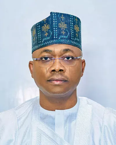
His Excellency Ahmed Usman Ododo
APC In office since 27 January 2024 · 1st term
View profileDeputy Governor
Salifu Joel Oyibo
History
Before colonial rule the area was divided between several polities: the Igala Kingdom centred on Idah in the east, the Ebira and Okun communities in the centre and west, and Nupe-related groups along the Niger, parts of which came under the Sokoto Caliphate's sphere in the 19th century.
Lokoja, at the confluence of the Niger and Benue rivers, became an early centre of British activity: a settlement was established there in the 1850s, and it served as the first administrative headquarters of the Protectorate of Northern Nigeria at the start of the 20th century. Local tradition links the coining of the name 'Nigeria' by Flora Shaw (later Lady Lugard) to the Niger at Lokoja, and colonial-era relics such as Lugard's rest house on Mount Patti survive.
After independence the area was split between Kwara and Benue-Plateau (later Benue) states. Kogi State was created on 27 August 1991 from the eastern (Igala) part of Benue State and the south-eastern part of Kwara State, taking its name from the Hausa word for river. It borders ten states and the Federal Capital Territory, more than any other Nigerian state.
People & Culture
Ethnic groups
- Igala
- Ebira
- Okun (Yoruba)
- Bassa
- Nupe
- Ogori-Magongo
- Oworo
- Gwari
Languages
- Igala
- Ebira
- Yoruba (Okun)
- Nupe (Bassa Nge, Kakanda, Kupa)
- Bassa-Komo
- Ogori
- Hausa
- English
Traditional institutions
- Attah Igala (Igala Kingdom, Idah)
- Ohinoyi of Ebiraland (Okene)
- Maigari of Lokoja
- Obaro of Kabba
- Kogi State Council of Traditional Rulers
Economy & Natural Resources
Agriculture employs most of the population, with yam, cassava, rice, maize, cashew, sesame, oil palm, cocoa and coffee among the main crops. The state is also one of Nigeria's most important solid-minerals and heavy-industry locations: the Obajana cement plant in Lokoja LGA is one of the largest in Africa, the Ajaokuta Steel Company and the Itakpe iron ore mine anchor the steel value chain, and there are coal deposits in the east around Okaba and Ankpa.
Lokoja's position on the Abuja-Lokoja highway and at the Niger-Benue confluence makes the state a key transit route between the North and the South, with potential for inland water transport and logistics.
Key sectors
- Agriculture
- Cement and solid minerals
- Iron and steel
- Coal
- Transport and logistics
- Tourism
Agricultural produce
- Yam
- Cassava
- Rice
- Maize
- Cashew
- Sesame
- Oil palm
- Cocoa
- Coffee
- Groundnut
- Livestock
Solid minerals
- Iron ore
- Limestone
- Coal
- Marble
- Kaolin
- Feldspar
- Talc
- Dolomite
- Tantalite
- Gold
Raw materials
- Limestone
- Iron ore
- Coal
- Cashew nuts
- Cassava
- Palm produce
- Kaolin
- Marble
Internally generated revenue: ₦43.9bn (2025) · Source: NBS, Internally Generated Revenue at State Level 2025 (figures as reported by Blueprint, 24 Sep 2026; rounded to N0.01bn)
Investment Opportunities
Iron and steel
Downstream steel and metal fabrication around the Ajaokuta Steel complex and the Itakpe iron ore deposit.
Cement and building materials
Extensive limestone, marble and clay deposits support cement, aggregates and ceramics production.
Coal and energy
Coal deposits in Kogi East offer opportunities for mining and coal-to-power or industrial heat projects.
Agro-processing
Cashew, cassava, rice and sesame processing for domestic and export markets.
Inland waterways and logistics
River ports and logistics hubs at the Niger-Benue confluence and along the Abuja-Lokoja corridor.
Interested in Kogi?
Submit your proposal and the Secretariat will connect you with the state's investment agency.
Tourism & Heritage
Mount Patti
A hill overlooking Lokoja and the Niger-Benue confluence, with Lord Lugard's colonial rest house at its summit.
Niger-Benue confluence
The meeting point of Nigeria's two largest rivers, visible from Lokoja.
Colonial relics of Lokoja
Sites such as the first prison yard in Northern Nigeria, the World War cenotaph and early mission schools.
Ogidi rock formations
Granite inselbergs around Ogidi in Ijumu LGA, associated with a traditional crafts industry.
Ohinoyi's palace, Okene
The palace of the paramount ruler of Ebiraland.
Gallery
Local Government Areas
21 local government areas
- Adavi
- Ajaokuta
- Ankpa
- Bassa
- Dekina
- Ibaji
- Idah
- Igalamela-Odolu
- Ijumu
- Kabba/Bunu
- Kogi (Koton Karfe)
- Lokoja
- Mopa-Muro
- Ofu
- Ogori/Magongo
- Okehi
- Okene
- Olamaboro
- Omala
- Yagba East
- Yagba West