
Niger State
“The Power State”
- Capital
- Minna
- Created
- 1976 3 Feb
- Population
- 6.8M 2022 est.
- Land area
- 76,363 km²
- Density
- 89 people / km²
- LGAs
- 25 local governments
- IGR
- ₦66.4bn 2025
Overview
Niger State is in the North-Central geopolitical zone of Nigeria, with its capital at Minna. It was created on 3 February 1976 from North-Western State, under the Murtala Mohammed administration (Borgu was added from Kwara State in 1991). It has an estimated population of 6,783,300 (2022) across 76,363 km², administered through 25 local government areas.
Major towns
- Minna
- Bida
- Kontagora
- Suleja
- New Bussa
- Mokwa
- Lapai
- Agaie
- Kagara
- Zungeru
- Madalla
- Rijau
Leadership

His Excellency Mohammed Umaru Bago
APC In office since 29 May 2023 · 1st term
View profileDeputy Governor
Yakubu Garba
History
The territory of Niger State includes the heartland of the Nupe Kingdom, traditionally founded by Tsoede, as well as Gbagyi, Kambari and Hausa communities and the Borgu kingdom in the west. Following the Fulani jihad of the early 19th century, emirates were established at Bida, Kontagora, Agaie, Lapai and Abuja (now Suleja) within the Sokoto Caliphate.
Under British rule Zungeru served as the capital of the Protectorate of Northern Nigeria from 1902 until the capital moved to Kaduna, and Minna grew as a railway junction on the Lagos-Kano line. At independence the area was part of the Northern Region and, from 1967, of North-Western State.
Niger State was created on 3 February 1976 with Minna as capital, and gained the Borgu area from Kwara State in 1991. It is Nigeria's largest state by area and hosts the Kainji, Jebba and Shiroro hydroelectric dams, together with the more recent Zungeru power station, giving rise to its nickname 'The Power State'. Since the late 2010s parts of the state have suffered from banditry and insecurity.
People & Culture
Ethnic groups
- Nupe
- Gbagyi
- Hausa
- Fulani
- Kambari
- Kamuku
- Busa
- Dukawa
- Koro
Languages
- Nupe
- Hausa
- Gbagyi
- Kambari
- Fulfulde
- Busa
- Kamuku
- English
Traditional institutions
- Etsu Nupe (Bida Emirate)
- Emir of Minna
- Emir of Kontagora
- Emir of Suleja
- Emir of Borgu (New Bussa)
- Emir of Agaie
- Emir of Lapai
- Emir of Kagara
- Niger State Council of Chiefs
Economy & Natural Resources
Niger's economy is dominated by agriculture on its extensive fertile land: it is a major producer of rice, maize, sorghum, millet, yam, soybean, sesame, groundnut and shea, with significant livestock and freshwater fisheries on Kainji Lake and the Niger and Kaduna rivers.
The state's hydroelectric dams make it central to Nigeria's power supply. It also has deposits of gold, talc, kaolin, marble, iron ore and lead-zinc, and its border with the Federal Capital Territory has turned Suleja, Madalla and Tafa into fast-growing commuter and trading towns.
Key sectors
- Agriculture
- Hydroelectric power
- Livestock and fisheries
- Solid minerals
- Trade and logistics
Agricultural produce
- Rice
- Maize
- Sorghum
- Millet
- Yam
- Soybean
- Sesame
- Groundnut
- Shea nut
- Cowpea
- Sugarcane
- Livestock
- Fish
Solid minerals
- Gold
- Talc
- Kaolin
- Marble
- Iron ore
- Lead-zinc
- Feldspar
- Granite
- Clay
- Columbite
- Tantalite
Raw materials
- Rice paddy
- Shea nuts
- Soybeans
- Sesame seed
- Talc
- Kaolin
- Fish
Internally generated revenue: ₦66.4bn (2025) · Source: NBS, Internally Generated Revenue at State Level 2025 (figures as reported by Blueprint, 24 Sep 2026; rounded to N0.01bn)
Investment Opportunities
Large-scale agriculture and mechanisation
Abundant arable land and irrigation potential along the Niger and Kaduna rivers suit rice, maize and soybean farming and processing.
Energy
Hydropower host communities, transmission and power-intensive industries near the Kainji, Jebba, Shiroro and Zungeru plants.
Shea and oilseed processing
Shea, sesame and soybean processing for export markets.
Solid minerals
Gold, talc and kaolin deposits offer opportunities for licensed mining and processing.
Real estate and logistics
Suburban development along the Suleja-Madalla corridor bordering Abuja.
Interested in Niger?
Submit your proposal and the Secretariat will connect you with the state's investment agency.
Tourism & Heritage
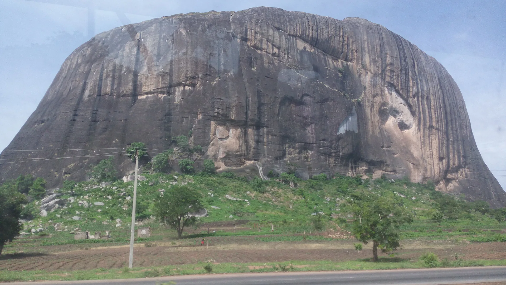
Zuma Rock
A massive granite monolith near Madalla, Suleja LGA, featured on the N100 note.
Gurara Falls
A broad seasonal waterfall on the Gurara River in Gurara LGA.
Kainji Lake National Park
Nigeria's oldest national park, comprising Kainji Lake and the Borgu and Zugurma sectors.
Bida brass and glass crafts
Traditional Nupe metalwork, glass-bead and craft guilds in Bida.
Zungeru colonial relics
Remnants of the early colonial capital of Northern Nigeria.
Gallery
Local Government Areas
25 local government areas
- Agaie
- Agwara
- Bida
- Borgu
- Bosso
- Chanchaga
- Edati
- Gbako
- Gurara
- Katcha
- Kontagora
- Lapai
- Lavun
- Magama
- Mariga
- Mashegu
- Mokwa
- Munya
- Paikoro
- Rafi
- Rijau
- Shiroro
- Suleja
- Tafa
- Wushishi