
Kwara State
“State of Harmony”
- Capital
- Ilorin
- Created
- 1967 27 May
- Population
- 3.6M 2022 est.
- Land area
- 36,825 km²
- Density
- 96 people / km²
- LGAs
- 16 local governments
- IGR
- ₦95.4bn 2025
Overview
Kwara State is in the North-Central geopolitical zone of Nigeria, with its capital at Ilorin. It was created on 27 May 1967 from Northern Region (Ilorin and Kabba provinces), created as West Central State and renamed Kwara in 1976. It has an estimated population of 3,551,000 (2022) across 36,825 km², administered through 16 local government areas.
Major towns
- Ilorin
- Offa
- Omu-Aran
- Jebba
- Lafiagi
- Pategi
- Kaiama
- Share
- Erin-Ile
- Oro
- Bode Saadu
- Kosubosu
Leadership
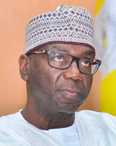
His Excellency AbdulRahman AbdulRazaq
APC In office since 29 May 2019 · 2nd term
View profileDeputy Governor
Kayode Alabi
History
Much of present-day Kwara lay within or on the margins of the Oyo Empire, with Nupe communities in the north-east and Bariba (Baatonu) and Busa communities of the Borgu kingdoms in the west. In the early 19th century the revolt of Afonja, the Oyo commander at Ilorin, and the subsequent rise of a Fulani emirate under the descendants of Sheikh Alimi made Ilorin the southernmost emirate of the Sokoto Caliphate, under the Gwandu sphere.
The Royal Niger Company took Ilorin in 1897 and the area was incorporated into the Protectorate of Northern Nigeria. At independence it formed the Ilorin and Kabba provinces of the Northern Region.
The state was created on 27 May 1967 as West Central State, one of the original 12 states, and renamed Kwara (a local name for the River Niger) in 1976. Its territory was reduced in 1976, when the Igala area went to Benue State, and in 1991, when five LGAs became part of the new Kogi State and Borgu LGA was transferred to Niger State.
People & Culture
Ethnic groups
- Yoruba
- Nupe
- Fulani
- Baatonu (Bariba)
- Busa (Boko)
- Hausa
Languages
- Yoruba
- Nupe
- Baatonum (Bariba)
- Busa
- Fulfulde
- Hausa
- English
Traditional institutions
- Ilorin Emirate (Emir of Ilorin)
- Lafiagi Emirate
- Pategi Emirate
- Shonga Emirate
- Kaiama Emirate
- Olofa of Offa
- Olomu of Omu-Aran
Economy & Natural Resources
Agriculture remains the largest employer, with cassava, yam, maize, rice, sorghum, sugarcane, cashew, shea, cocoa and kola nut among the main products, and commercial farming clusters such as Shonga Farms in Edu LGA. Ilorin is a growing services, education and administrative centre, home to several universities and a federal airport.
The state has a significant manufacturing base in Ilorin (including food, beverages and packaging) and deposits of gold, marble, feldspar, kaolin, tantalite and other minerals. Recent state investments have targeted the creative economy, garment manufacturing and technology, and Kwara has consistently ranked among the higher-earning northern states in internally generated revenue.
Key sectors
- Agriculture
- Agro-processing and manufacturing
- Education services
- Creative economy and tourism
- Technology and innovation
- Solid minerals
Agricultural produce
- Cassava
- Yam
- Maize
- Rice
- Sorghum
- Sugarcane
- Cashew
- Shea nut
- Cocoa
- Kola nut
- Soybean
- Livestock
Solid minerals
- Gold
- Marble
- Feldspar
- Kaolin
- Limestone
- Tantalite
- Quartz
- Granite
- Clay
Gemstones
- Tourmaline
Raw materials
- Cassava
- Sugarcane
- Shea nuts
- Cashew nuts
- Marble
- Kaolin
- Feldspar
Internally generated revenue: ₦95.4bn (2025) · Source: NBS, Internally Generated Revenue at State Level 2025 (figures as reported by Blueprint, 24 Sep 2026; rounded to N0.01bn)
Investment Opportunities
Agro-processing
Cassava, rice, sugarcane, shea and cashew processing, building on existing commercial farm clusters.
Garments and light manufacturing
The state-built garment factory in Ilorin targets export-oriented apparel production.
Technology and creative industries
The Ilorin Innovation Hub and the Kwara Visual Arts Centre provide infrastructure for startups and film/arts production.
Solid minerals
Marble, feldspar, kaolin and gold deposits offer opportunities for processing and industrial minerals.
Hospitality and tourism
Ilorin's proximity to Lagos and Abuja by rail and road supports hotels, events and eco-tourism around Owu Falls and Kainji.
Interested in Kwara?
Submit your proposal and the Secretariat will connect you with the state's investment agency.
Tourism & Heritage
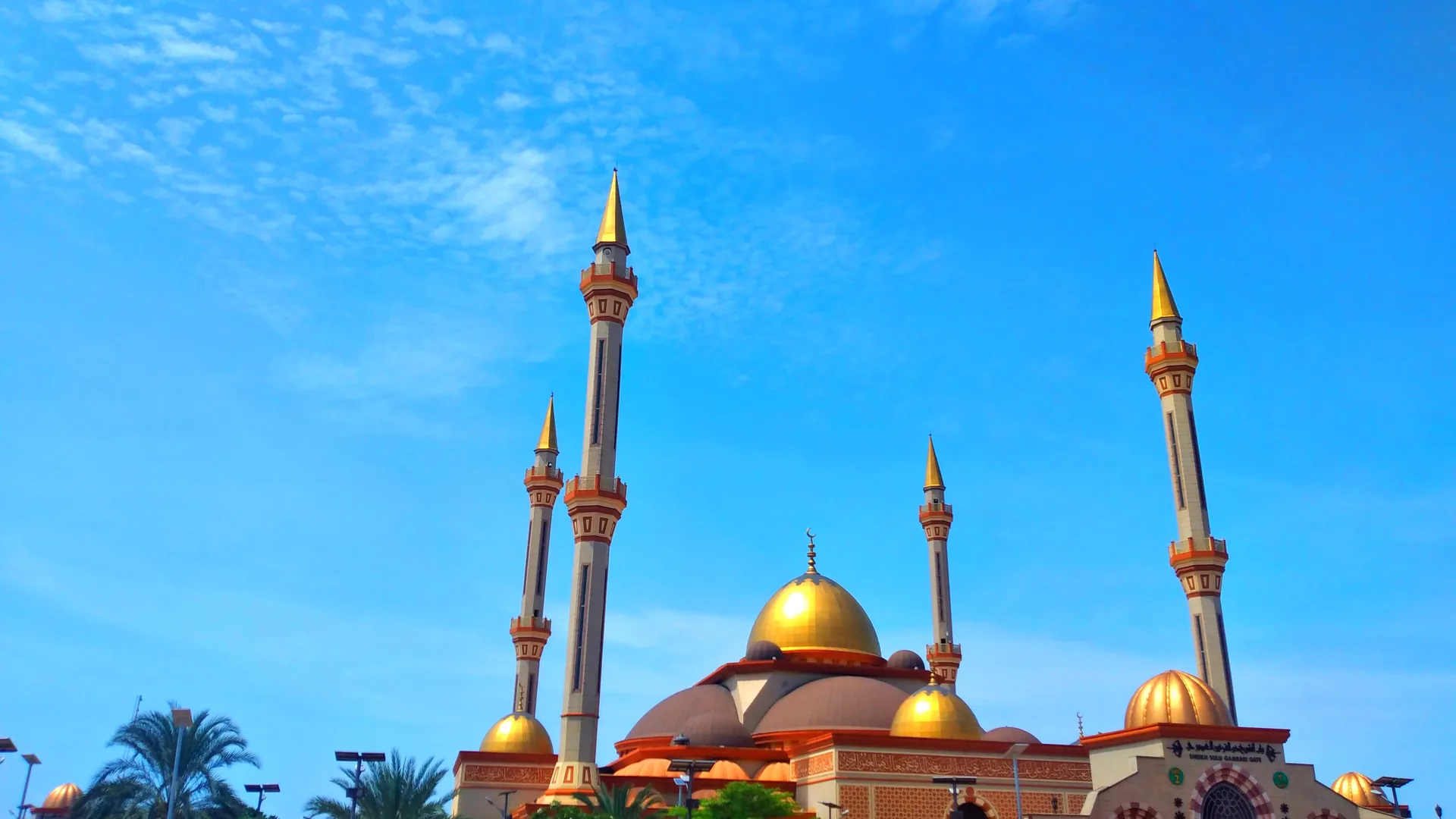
Ilorin Central Mosque
A landmark mosque with golden domes and minarets near the Emir's palace in central Ilorin.
Owu Waterfalls
A high, multi-tiered waterfall in Owa-Onire, Ifelodun LGA.
Esie Museum
Nigeria's first museum (1945), housing hundreds of ancient soapstone figures.
Sobi Hill
The highest landform in Ilorin, offering views over the city.
Kainji Lake National Park (Borgu sector environs)
Savanna wildlife habitats along the Niger on the state's north-western edge.
Gallery
Local Government Areas
16 local government areas
- Asa
- Baruten
- Edu
- Ekiti
- Ifelodun
- Ilorin East
- Ilorin South
- Ilorin West
- Irepodun
- Isin
- Kaiama
- Moro
- Offa
- Oke-Ero
- Oyun
- Pategi